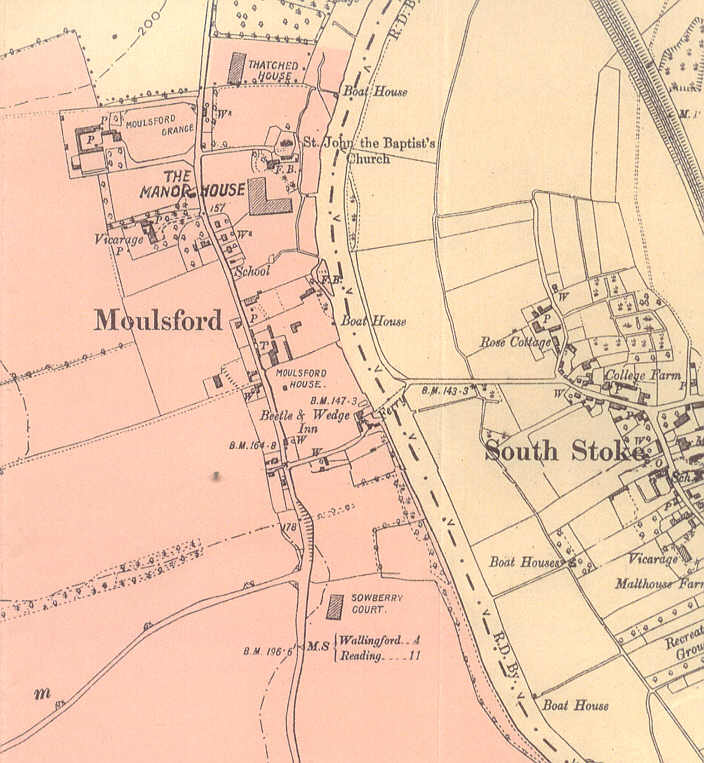
Map from Moulsford Sale Book
Below is a small section of the plat map
enclosed
with the sale book. The land shaded in pink was part of the
estate,
which stretched well to the south and west, for a total of nearly four
square
miles. The current owners of Moulsford Manor think that the map dates
from
a different year than that of the sale, because the Manor is depicted
in
an "L" shape. At the time of this sale, it must have had an
additional
wing based upon the rooms described.
The western reaches of the property may be viewed
here. Use your "back" button to return.
Copyright © 2004 Thomas
Payne